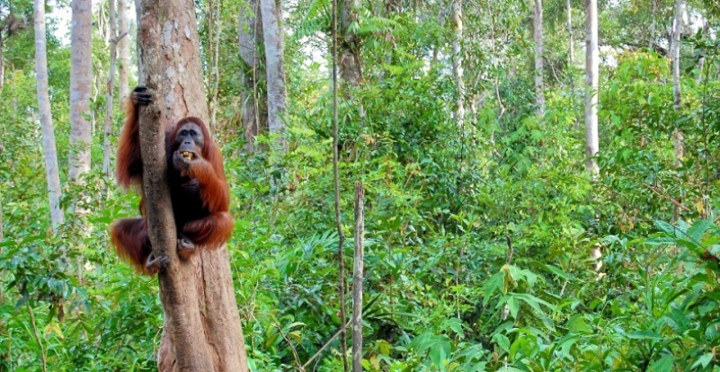
Orang utan di Pulau Kaja, Kalimantan Tengah. Provinsi ini Provinsi Kalimantan Tengah menjadi yang pertama melaksanakan INCAS sebelum diperluas secara nasional. Terry Sunderland/CIFOR
JAKARTA, Indonesia—It has one of the world’s largest forest estates…. and one of the highest rates of deforestation and degradation. The government of Indonesia has a serious target: reducing greenhouse gas (GHG) emissions by 26 percent by 2020, and – if international assistance is forthcoming – by 41 percent during that same period.
To assist in that aim, a monitoring system to track the country’s GHG emissions has been developed by the Indonesian government.
The Indonesian National Carbon Accounting System (INCAS) will serve as the basis for the country’s measurement, reporting, and verification (MRV) system for the land sector.
MRV is required under the UN Framework Convention on Climate Change (UNFCCC).
The Minister of Environment and Forestry, Siti Nurbaya formally endorsed INCAS, at a recent public seminar in Jakarta.
“We all realize that deforestation, degradation, and forest fires contributed to greenhouse gas emissions. With this INCAS method, we can actually move forward, at least figure out emissions figures and not just all talk,” said Minister Nurbaya at the INCAS seminar.
INCAS is designed to bring together best available spatial, biophysical and land management data from across the nation, to quantify changes in carbon stocks and greenhouse gas emissions in the agriculture, forestry and other land use sectors in Indonesia.
“INCAS will serve as a singular national platform, meaning that resources can be devoted to the one centralized system that produces GHG estimates for all of Indonesia’s emissions reporting needs, rather than needing to develop and operate several different individual systems,” says Tom Harvey, the Center for International Forestry Research (CIFOR’s) manager of the INCAS program.
INCAS is an open, transparent, and continually improving framework, which is designed to incorporate new data, and technology as it becomes available
INCAS uses a Tier 3 approach for forestland that includes a carbon mass balance model, and a Tier 2 type approach for peatlands. Both tiers use nationally specific data.
“The INCAS is an open, transparent, and continually improving framework, which is designed to incorporate new data, and technology as it becomes available,” says Harvey.
In her foreword to the publication that outlines the INCAS methods launched at the seminar, Minister Nurbaya wrote “I am hopeful that the establishment of the INCAS as Indonesia’s official MRV system for the land sector will increase investor confidence in REDD+ activities in our country and will assist us in confidently transforming the way we manage our land sector in a more environmentally, socially and economically sustainable manner.”
Central Kalimantan province was the first to demonstrate the use of INCAS before it extends nationally.
The interim results are the first time that a GHG emissions profile has been broken down into its “constituent elements of forest carbon stock change, non-CO2 emissions from biomass burning, CO2 and non-CO2 emissions from mineral soil, as well as biological oxidation and direct N2 O, dissolved organic carbon and CH4 emissions from disturbed peat, and CO2 and non-CO2 emissions from peat fire”.
I am hopeful that the establishment of the INCAS will increase investor confidence in REDD+ activities in our country and will assist us in confidently transforming the way we manage our land sector in a more environmentally, socially and economically sustainable manner
The data – gathered between 2000 and 2011 – showed significant annual variations in GHG emissions and removals in Central Kalimantan, which are indicative of issues around historical land management, current practices, and weather patterns – like dry years and high incidents of fire.
The year with greatest GHG emissions was 2006 with 195 million t CO2 –e. The lowest year was 2010 with 74 million t CO2 -e.
Biological oxidation of peatlands was generally the largest single source of emissions, although peat fires in 2006 and 2009 greatly contributed to the elevated emissions in those years.
Central Kalimantan’s high peatland emissions are a result of the clearing and draining in the years prior to the reporting period, making those areas highly susceptible to oxidation and fire.
The INCAS system will expand in the coming months, to produce national level estimates of greenhouse gas emissions and removals from all of Indonesia’s forest and peat lands.
Once INCAS is applied across the entire country, the detailed data will support the government’s efforts to manage emissions and design mitigation actions that meet other national needs, including for sustainable land-use planning purposes.
It also means it will be possible for Indonesia to report all GHGs required by the UNFCCC National Communications and Biennial Update Reports.
Expansion means that “we will have more calculations of emissions before the Paris COP (in December 2015),” says Minister Nurbaya.
“In fact, we want them as soon as possible.”
For further information about the INCAS system, please contact T.Harvey@cgiar.org

